Energy Seen from Earth and Sky

Updated on 05.26.2023
Elementary Middle School
History, geography and geopolitics

5 min read

Major energy facilities leave their temporary or lasting mark on the surface of the Earth. Satellite images provide some striking examples.
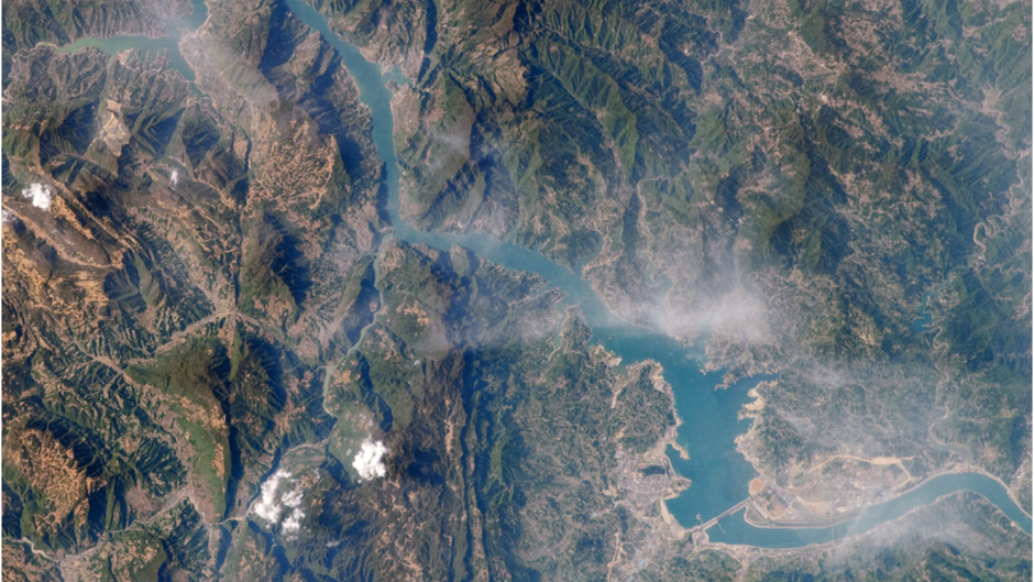
The three Gorges Dam from Sky

1. The largest dam in the world
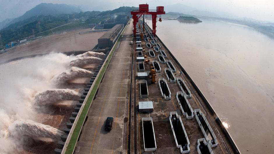
The Yangzi Jiang, previously known as the Yangtze, has the third-greatest water flow of any river in the world, after the Amazon and the Congo. It rises on the Tibetan Plateau and runs 6,400 kilometers to reach the sea at Shanghai. It is now regulated by the Three Gorges Dam, which created a 680-kilometer-long reservoir that displaced an estimated 1.8 million people and flooded 130 towns. It can be clearly seen in the bottom of this photograph.

The Three Gorges Dam from Earth

2. The equivalent of 20 nuclear reactors
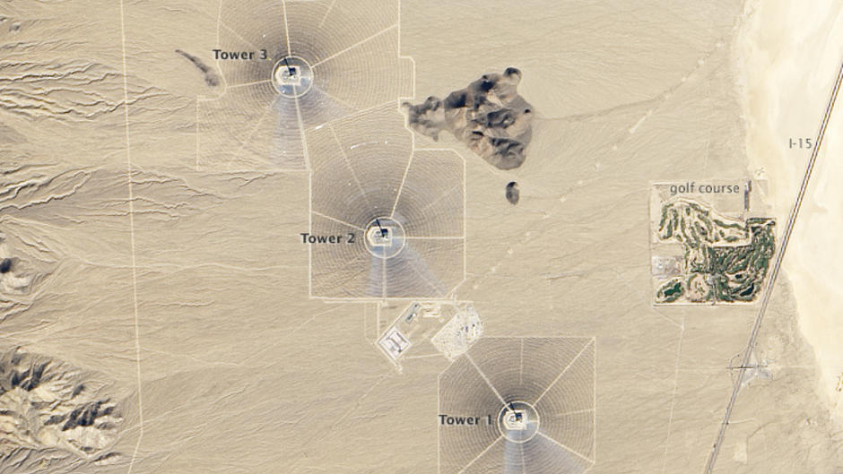
The Three Gorges Dam – 2,309 meters long and 185 meters above sea level at its highest point – began operation in 2006. With its three hydroelectric plants, 34 turbines and total of 22,500 megawatts, it is the world's largest hydropower station. Thanks to a system of staircase locks, the river can now be safely navigated – a previously dangerous task due to a string of narrow gorges.

The Ivanpah Facility from Sky

3. Reflections of concentrated solar power
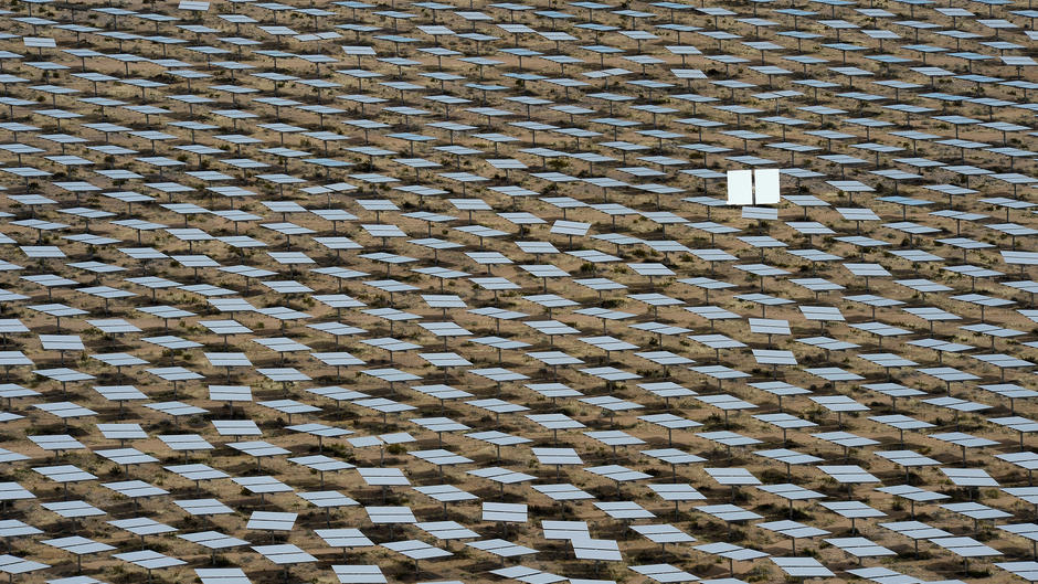
The Ivanpah facility in the Mojave Desert in Southern California is one of the largest concentrated solar thermal plants on Earth, with 392 megawatts of installed capacity. Mirror arrays at the facility's three sites capture sunlight and focus the solar energy on boilers located at the top of 120-meter-high concrete towers. This image shows that each of the three sites is as big as a golf course.

The Ivanpah Facility from Earth

4. A sea of mirrors covers the ground

Nearly 350,000 computer-operated mirrors follow the movement of the sun to guarantee maximum production efficiency. The solar energy is concentrated to produce steam, which turns the turbines to generate .

Kashagan complexe from sky

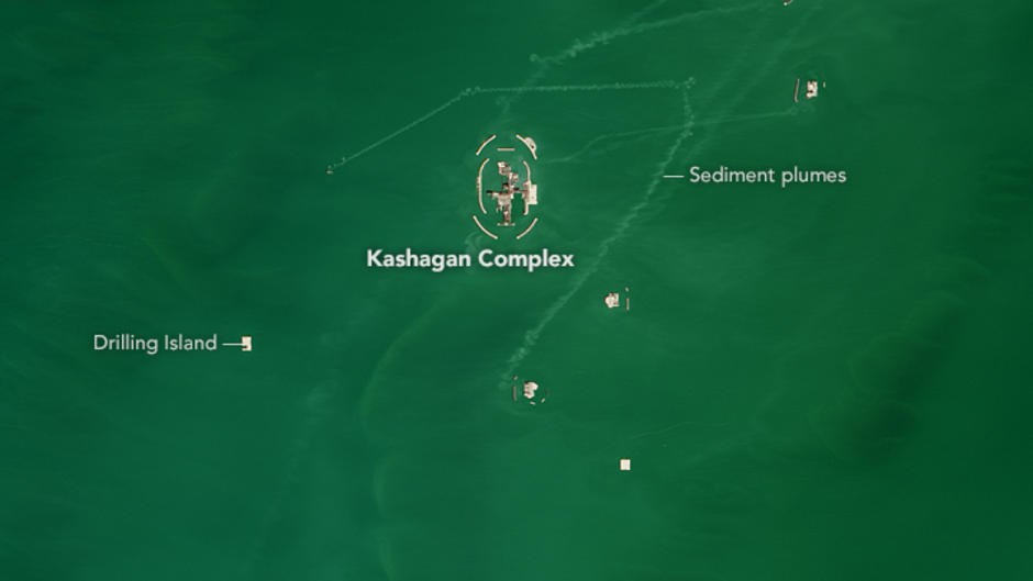
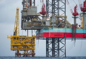
5. Hard-to-access oil and gas in the Caspian Sea

Kazakhstan's Kashagan oil and gas field in the Caspian Sea is one of the most promising in the world. However, operations are far from straightforward as the shallow waters are frozen for half of the year. Artificial islands – the small white dots in this satellite image – connected to a central complex had to be constructed to support the equipment. The sediment plumes seen in the image are created by underwater currents.

Kashagan complexe from Earth

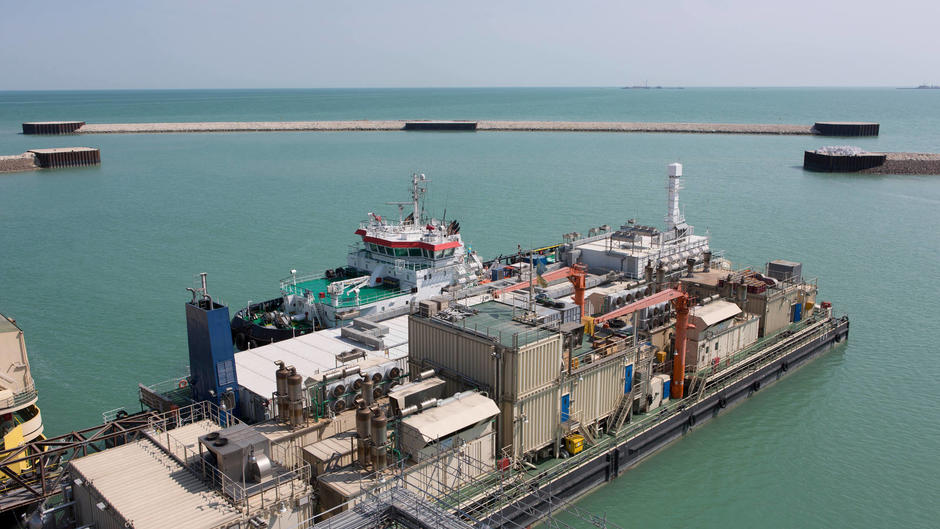
6. The artificial "Island D"

Oil and gas are produced on Kashagan's artificial islands (such as the one shown in this photograph) then delivered to the central complex. Pipelines transport the oil and gas to the shore where the vast Bolashak processing plant has been constructed. The plant purifies the oil for exportation and removes the sulfide from the natural gas.

Eagle Ford Shale from Sky

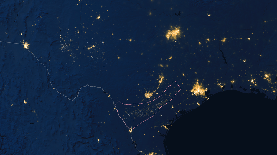
7. Texas' shale wells light up the night

West of the Rio Grande, east of Houston and south of San Antonio and Austin, the Eagle Ford Shale field (the area within the dotted lines) is 600 kilometers long and 80 kilometers wide and produces Texas' and gas. At the beginning of the 2000s, the area was deserted. Today, the population has grown from 4,000 to 10,000 as mushroom towns spring up across the region.  

Bakken Shale

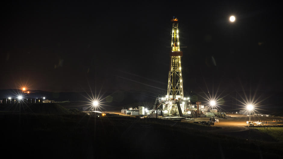
8. A labyrinth of vertical and horizontal wells

produced by , or fracking, requires an exceptionally dense drilling network to connect as much rock as possible. Production wells for are first drilled vertically  and then horizontally. Drilling operations often never stop, continuing day and night, as is the case at the Bakken Shale formation in South Dakota.

Coal Mining in Appalachian Mountains

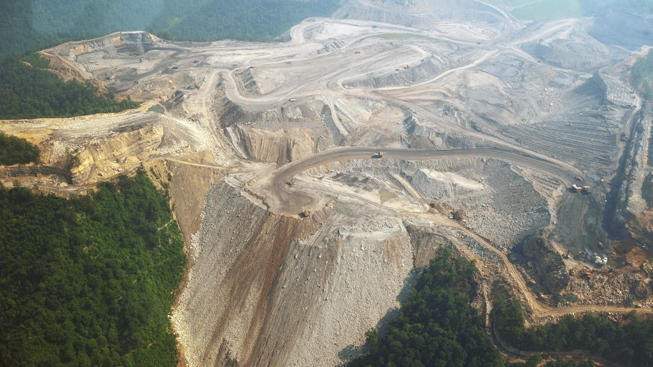
9. Mountaintop removal in the Appalachians

mining in West Virginia's Appalachian Mountains in the United States is striking: seams are not mined deep below ground but at the upper levels of the mountains, where the summits are "opened" using explosives. The coal is then removed, layer after layer, using open-pit mining techniques.

Kayford Mountain Coal Mine from Sky

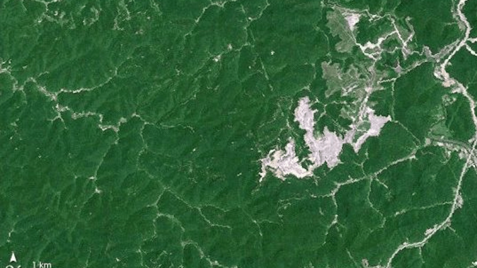
10. Kayford Mountain, June 1987

This photograph taken by NASA shows the Kayford Mountain coal mine in the Appalachian Mountains of West Virginia. The areas in white are summits that have been cleared of forest and then penetrated using explosives to reveal the coal beds. 

Kayford Mountain

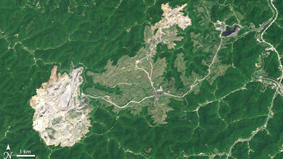
11. Kayford Mountain, May 2002

Fifteen years later, the operations have moved west and the increase in the surface area of the mine (in white) is clearly visible. However, once the coal has been extracted, the open-pit mine is abandoned and the landscape is reforested. In the light gray-green areas in the photo, forests are slowly growing back... at a slightly lower altitude than before. 

Pollution Problems in China from Sky

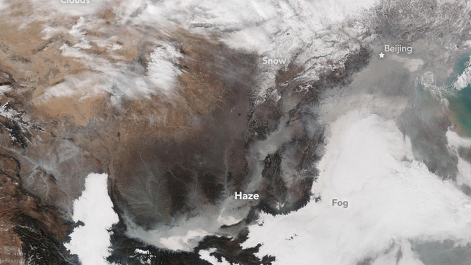
12. Pollution problems in China
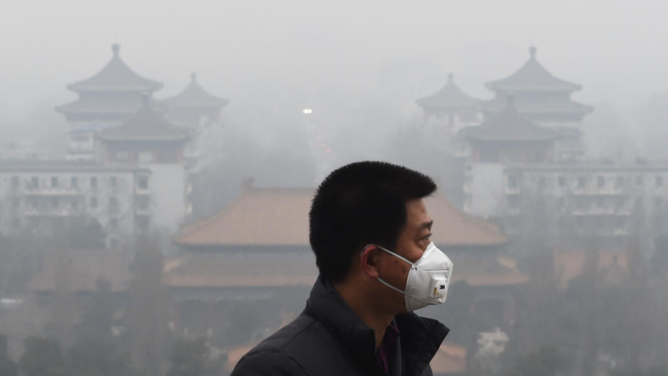
Massive coal use in China is creating levels of pollution that have become a major problem for the authorities in Beijing. They are trying to address the issue by diversifying their energy sources. In this photograph, the gray clouds of pollution, identified as "haze" by NASA, can be clearly distinguished from the far whiter clouds and fog. 

Pollution in China

13. At ground level, the air is unbreathable

The serious levels of pollution often make life unbearable for people in China, in both the cities and the countryside. In this photo, taken in Beijing during one of the many red alerts triggered by the local authorities, a man wears a mask to protect himself.

Deforestation from Sky

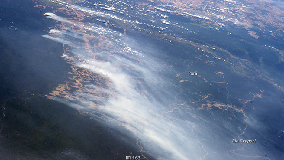
14. Deforestation, a major climate-change challenge

Forests are natural carbon sinks that are becoming an endangered heritage. In the Amazon rainforest, farmers set fire to vegetation to clear new fields for cultivation, creating long plumes of smoke. The brownish red areas in the photograph are cultivated lands that stand out from the dark green of the equatorial forest.

Deforestation from Earth

15. Land is often vital for survival

Clearing forest to make way for farmland is often essential to feed local communities. This photograph shows Yanomami indians in the Brazilian state of Roraima, clearing a parcel of land claimed using slash-and-burn techniques. In other parts of the world, forest species are endangered by mining or industrial agriculture, such as oil palm cultivation in Indonesia.

Our most popular content

See all